

Written by PhD student Megan Sherlock from SCENARIO DTP
There are many surprising, and often uplifting, new methods of utilising satellite imagery to protect and restore our natural world.
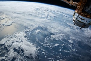
Satellite imagery has been used within the world of academia for decades now, allowing us to observe weather patterns, monitor biodiversity loss and track environmental dangers like forest fires. The sharing of such data from satellite-owning companies, such as NASA and NOAA are crucial to these areas of research, as many scientists simply do not have the funding available to pay for access.
A talk entitled “The power of space to protect & restore our natural world” at COP28 highlighted not just how important this open access is, but also the wide variety of research for which satellite imagery can be used.
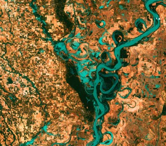
Indigenous speakers described how satellite imagery was used to resolve disputes with local government over territory boundaries, as third-party maps (such as National Geographic or ArcGIS) clearly showed where indigenous land margins lay. Another attendee highlighted how illegal poaching and logging can be disrupted, using recent satellite images to locate and apprehend offenders. They celebrated how this has led to a 2/3 decrease in illegal logging activity within Kenya, as offenders knew that they were being watched from space.
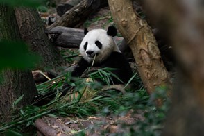
Furthermore, high resolution satellite images can be used to protect and conserve individual animal species. Solitary species, such as polar bears or snow leopards, can be tracked across land to map territory sizes, creating more accurate population estimates. Heavily populated areas of elusive species, such as the giant panda, can also be located to ensure that human infrastructure and developments do not disturb them, or destroy their habitat.
Satellite imagery can be used for a variety of purposes by a variety of people, not just traditional scientists as previously assumed. Although it can provide more accurate monitoring of our natural systems than traditional methods, satellite images are currently underutilised in the integrated nature and climate agenda. Once policymakers take the role of satellite imagery in the fight against climate change seriously, we can begin to use it more readily to enact change. Thus, images from space can help to protect and restore our natural world.